NO. The Western Interior Seaway Did NOT Exist Just Before the Time of Christ.
In this article, I will attempt to show as persuasively as possible, the INSURMOUNTABLE problem behind the idea proposed by Michael P in his YouTube video titled “Where was the west sea in The Book in Mormon?”
As a prelude, let me start by saying I love the inquisitive, problem solving approach Michael P is aiming at in this video and all his videos. But let me also make clear, that as a geologist who has worked for the Geologic Survey for 20 years specializing in geologic teaching and visualizations, Michael just doesn’t understand the science behind what he’s proposing. I’ve also worked for 20+ years to find ways the reconcile scriptural ideas such as Noah’s Flood or catastrophic destructions spoken of in the Book of Mormon with geologic evidence. And can say categorically, that the ideas proposed in this video are simply IMPOSSIBLE given the evidence.
.
Put simply Michael obviously does not yet understand the evidence which makes his theory impossible.
- There are hundreds of archaeological sites, which date to before the time of Christ, UNDER his proposed sea. (Were these cities built underwater by ancient mermaid colonies? Or if you don’t trust the dates, why do you use them to date the Hopewell/Adana sites you use to match with the Jaredites/Nephites.)
- The Western Interior Seaway (actually called the Cretaceous Interior Seaway) existed during the Geologic Periods of the Cretaceous & Paleocene geologic periods. Geologically dated to 150-55 million years ago. (Dinosaurs are found in these layers.) The evidence of this ancient seaway comes from geologic deposits that greatly PREDATE or are OLDER than the geologic layers under the oldest archaeological sites in the world such as the Great Pyramids, Gobeki Tep, Babylon or Jerusalem. So even if you thing geologic dates are wrong, this sea would have dried up long before Moses, Abraham or the Jaredites.
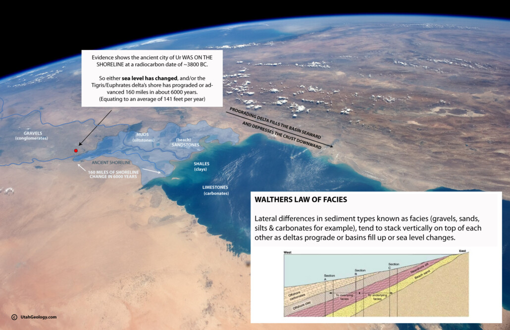
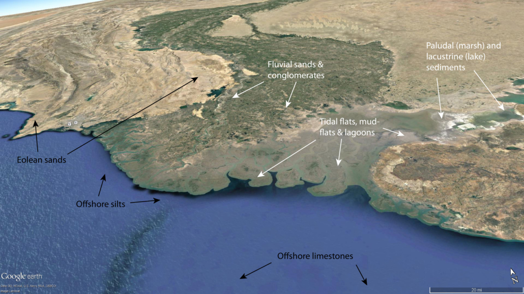
First off, let me help readers understand WHY, we geologists believe the Western Interior Seaway exists. Geologists can tell where oceans anciently existed because of the deposits the ALWAYS leave. And to understand those layers, one needs to understand the laws of superposition and Walther’s law of Facies stacking. Which Basically say that large lakes and ocean systems all have beaches, deltas, entering river system and deep water environments which all leave unique types of sediment deposits. Beaches leave sand, tidal flats leave tidal deposits, rivers leave gravels and muds, deltas leave muds and silts, offshore deposits create mudstone and limestone’s, etc. A trained geologist understands the differences between these units and how they stack over time as sea levels rise and fall, and can use the boundaries of those deposits to map the ancient shorelines.
.
Its the relationship between these well mapped rock/sediment types that has allowed geologists like myself and Ron Blakey to create the ‘paleogeography’ or ancient landscape maps which Michael uses in his video.
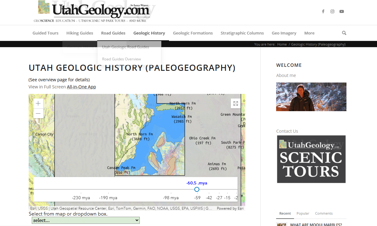
I have similar maps I have created on my popular geologic site, Utahgeology.com on my ‘geologic history section. (link here). In this page, you can move the time slider and see the ocean come and go. You can also go to other tabs to see the drill cores or “stratigraphic columns” of underground layers that these maps are based on.
You can see an animation of these seas as they come and go through time in this YouTube video.
.
Another way to explore the geologic units which are used to create these maps is available here. (I make maps like this for a living, and was among the first geologists in the world to do so… creating a world renown interactive mapping application for the state of utah here.
https://macrostrat.org/map/loc/-86.707/33.809#x=-101.397&y=38.344&z=4.2
https://geomap.geology.utah.gov
.
What I’d like to impress upon readers from this is how horribly Michael has inadvertently misrepresented the data which we geologist have provided to the public. To suggest that the Cretaceous Western Interior Seaway, which went all the way from Utah to Illinois, existed UNTIL THE TIME OF CHRIST, one has to completely disregard the following stratigraphic relationshps.
- That the Rocky Mountains formed AFTER the Western Interior Seaway. (so for Michael P’s theory to be right, the Rocky Mountains uplift and erosion has all happened in the last 2000 years)
- That the Wasatch Mountains, AND THEN the deposition of up to 10,000 feet of sediment came off them, AND THEN the formation of Lake Bonneville, AND THEN the three stage draining of Lake Boneville and formation of the Salt Flats… ALL occurred well AFTER the Western Interior Seaway. In other words those Cretaceous deposits sit under all these deposits, so for Michael P’s theory to be right, ALL these deposits and events happened AFTER the time of christ 2000 years ago.
- But… there are archaeological sites dating to Jaredite times sitting ON TOP of all the above deposits. So now we run into an impossibility.
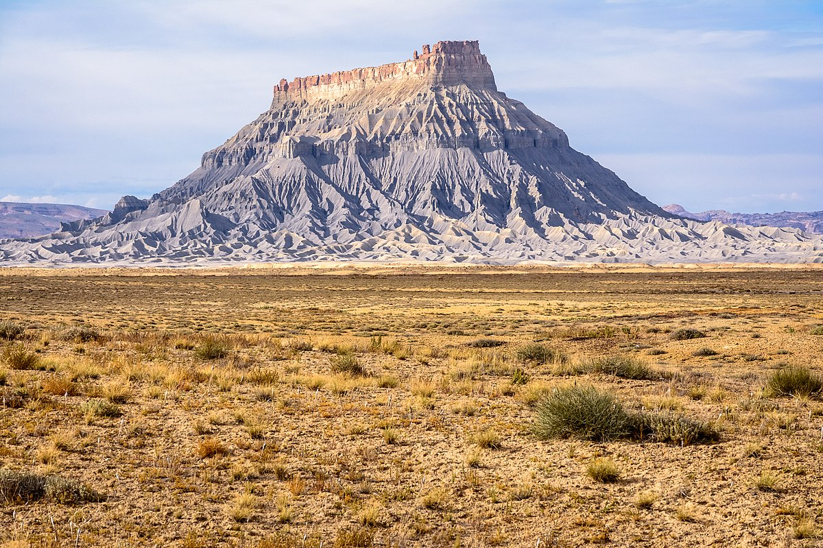
So just to illustrate. The layers labeled “grey cliffs” in this illustration of Utah’s grand staircase are the layers deposited in that sea way. (AND THAT WAS THE LAST TIME THERE WAS AN OCEAN IN THE US GREAT PLAINS).
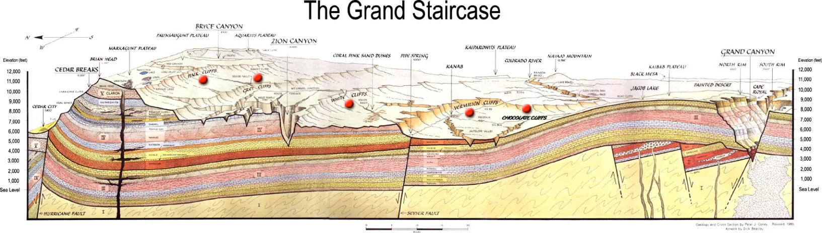
And those ‘grey cliffs’ which are made of sediments deposited in the Interior Seaway, traverse much of the state of Utah, and can be followed across the Rocky Mountains to Kansas and Iowa. (see Pierre Shale). And they sit THOUSANDS OF FEET BELOW sections of Lake Bonneville deposits. Which sit below layers with woolly mammoth fossils and earliest paleo Indian sites dating to 9000 BC such as Danger Cave or Lovelock Cave in Nevada which heartlanders often associate with Jaredite or preAdamites. But how can that be if these OLDER artifacts are ONTOP layers that were deposited BEFORE the time of Christ? It simply DOES NOT WORK.
.
Again, note that that ‘animated’ visualization above shows that the western interior seaway came down from Canada to split the continent in two. (not the ‘geologic date’ on the left pane is the date given by various geologic dating methods like Argon/Uranium series/zircon dating, which even if you want to contest it as an absolute date, can not be contested as a relative date) MEANING… the small sea you see at about 60 million years ago in the great plains PREDATES (sits well underneath) the deposits showing the rise of the rocky mountains, Wasatch mountain, lake Bonneville, and archaeological sites like the one’s I’ve spoken of.
Note that as a geologist I’m open to geologic dates being wrong or skewed. There is evidence that neutrinos currently affect radiometric decay rates by small amounts, so maybe we could hypothesize that in the past galactic conditions caused MASSIVE acceleration of radiometric decay. So one could suggest that the earliest fossils (which date to 500 mya) actually are 6000 years old. BUT there’s a lot of difficulties with that stance, when it comes to varve dating and the amount of geologic change in the stratigraphic record. But at least its at least within reason.
However, the law of superposition, dictates what is ‘within reason’. And that which breaks the law of superposition is impossible. And those who propose theories which break it, show they are ignorant. They suggest not just that radiometric dating or varve dating or tree ring dating is wrong (which is possible), but that the impossible.


